Alaska Bound
Section
2: On the Water - USA
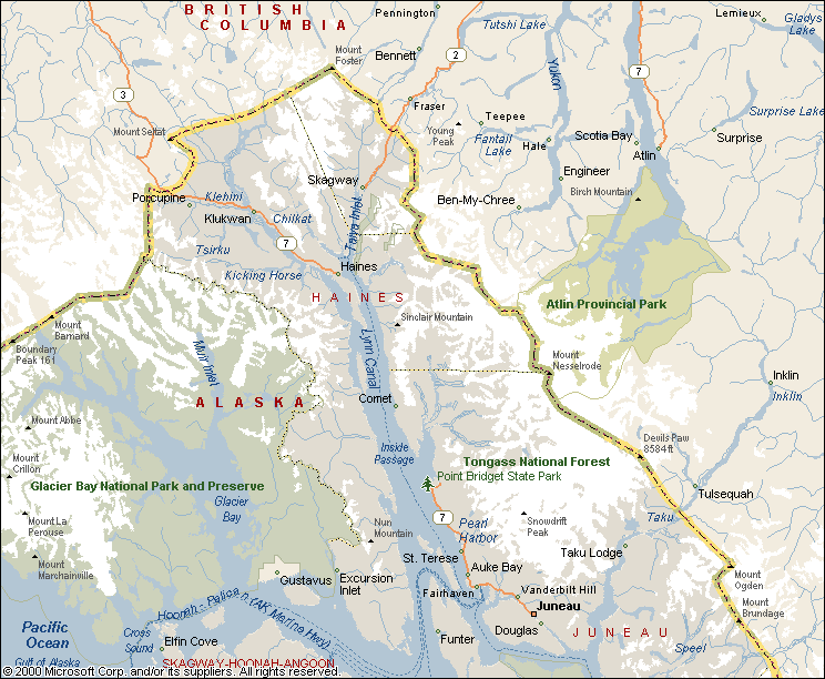
Map section #5
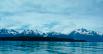
On June 28, 2000 we finally reached Alaska (or at least the charts and GPS
said so). This was a kind of psychological barrier for us to have
passed. No matter what happened from here on out we had made it to
Alaska. We had made it further north by boat than we had ever been before
(we had previously been to Prince Rupert once on the Ferry).
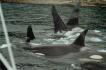
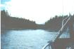
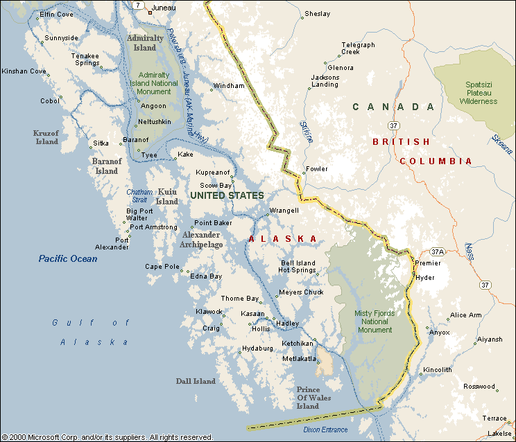
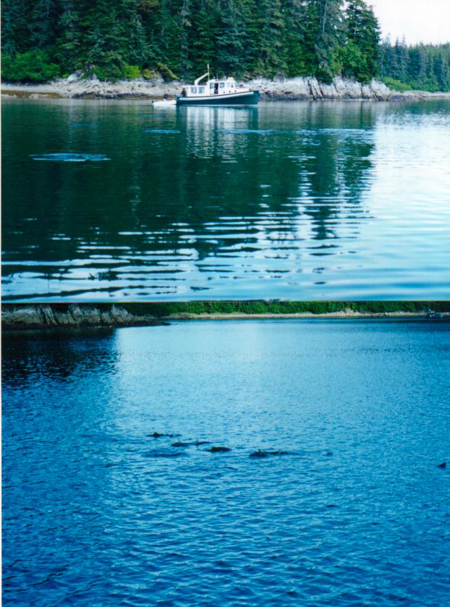
Orcas at our bow
As if to say you really made it to wild Alaska, we were
greeted as we entered the final channel
into Ketchikan by a pod of Orcas. I'm not
sure if they were herding fish or what but eventually their route
took them under our bow as we lay adrift.
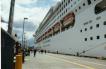
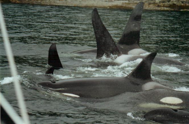
Cruise ship (floating resort), Ketchikan
We were surprised as we moved up the channel towards Ketchikan at the size of the office buildings in what we expected to
be a small town. On closer inspection we realized that one of the
"office skyscrapers" was moving.
We were astounded at the size of the mega cruise ships that
drop up to 14000 people (2000 passengers in 7 vessels) into this small
town early in the morning and then take them away in the evening.
We also learned that we often got a much warmer
reception from the locals when we introduced ourselves as being off a
small sailboat rather than a cruise liner.
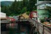
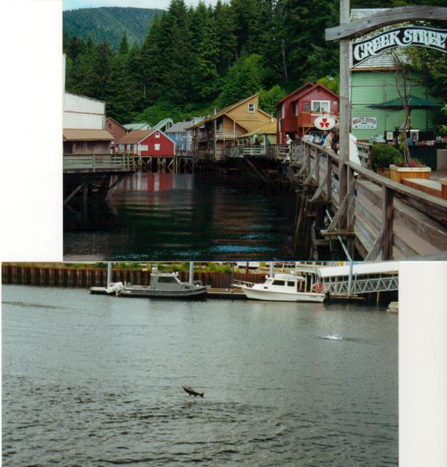
Creek Street and Jumping Salmon
While in Ketchikan we played tourist and visited Creek
Street, window shopped, oohed and aahed
at the jumping salmon, bought a fishing license for Clarice, washed
cloths, and filled my dive tanks (after I hauled them in a backpack on
the city bus across town). We stayed for two days
at the yacht club - not much by "lower forty eight" standards but
the showers were hot and we ran into our new friends again.
Ketchikan is known for its constant rain and we
weren't disappointed while we were there .
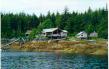
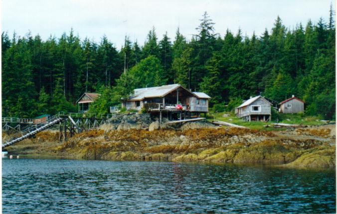
Meyer's Chuck
We spent the night of June 30 at the
public dock in Meyer's Chuck. After touring the sights (an abandoned
school and a local artist coop) we decided that
the definition of a "Chuck" must be a settlement around a small
cove that is too small to call a village. The creativity with which people managed to get their dwellings to stay put on
the tops of rocks was amazing.
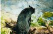
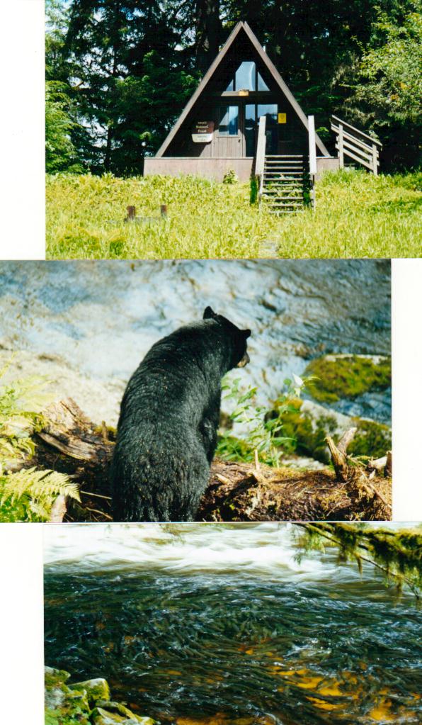
Anan Bay
The next night found us anchored in Anan Bay.
On the shores of Anan Bay the forest
service has one of its many hiker/boater/bush pilot cabins. A short walk
away is a bear watching/study station. The bears had only begun to
gather as the fish they sought were still just starting to gather at the
base of the falls below the station (look closely at the dark photo - I
had walked right past this section of the creek without realizing that
the dark bottom was actually the dark backs of thousands of salmon).

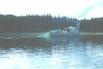
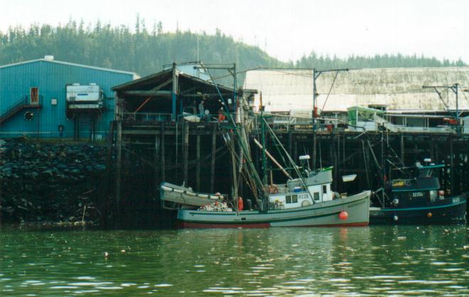
Fishing boat unloading at the processor
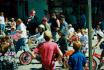
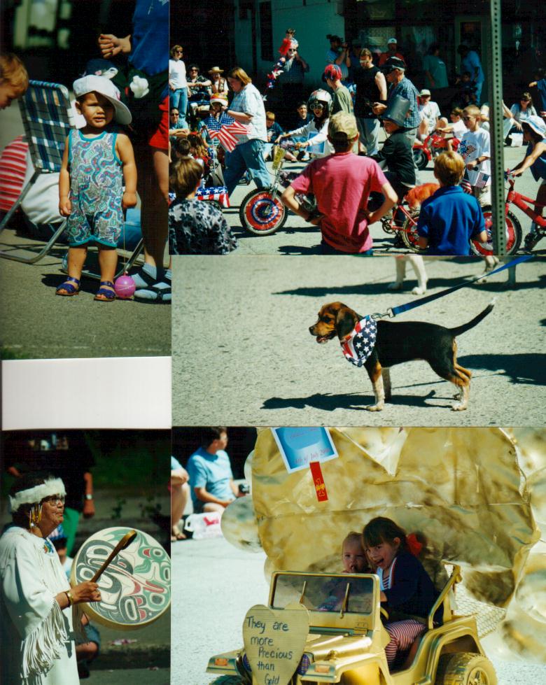
Small town 4th of July in Wrangell
July 2nd found us in the town of Wrangell. Having our first access to a telephone in several days we wanted to call and
wish our daughter Erin a slightly belated birthday only to get the awful
news that on her birthday her husband had been badly burned and had to be
flown to the regional burn center in Seattle. She assured us that
there was nothing we could have done and that
Clarice's parents had stepped in to help but we still felt guilty we weren't
there.
The locals in Wrangell convinced us that we would be missing a great
piece of Americana if we didn't stay for their
Fourth of July celebration. I "joined" the volunteer fire
department for 2 days and helped set up $10000 worth
of fireworks. We watched a good old fashioned small town parade,
ate at the local VFW booth, and bought raffle tickets to support the
local Fourth of July Queen and King. When it FINALLY got dark we
waited for the ultimate fireworks show (and we
waited, and waited - oops, the electronic fuses failed after ALL of those
hours and hours of work). The show was finally set off by hand with
flares, but while spectacular, was nothing like the plans had called for.
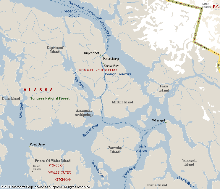
Map from Wrangell to Petersburg
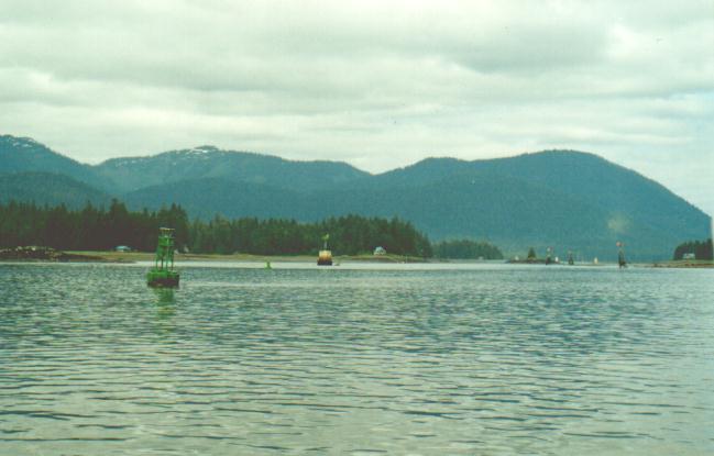
Channel markers in Wrangell
Narrows
From Wrangell we threaded our way through Wrangell narrows to
Petersburg. While the map makes the waters to the East of Farm Island
look passable but after discussions with the
locals we learned that the constantly changing alluvial fan from the Stitkene river makes this route virtually impassable.
Wrangell narrows is well marked and used by all of the commercial
traffic but is so narrow and convoluted that the
larger ships radio ahead to warn others that they are coming through.
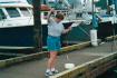
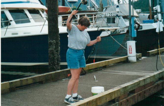
The Great Fisherwoman
When we were at the dock in Petersburg Clarice finally caught some fish.
They were only herring but they made a tasty meal.

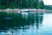
Tracy Cove
Before we left Petersburg we loaded up with as
much fuel as we could carry. We had fuel in both main tanks, a 5 gallon
tank on the stern, a 5 gallon tank between our feet in the cockpit and a couple
of 5 gallon tanks towed in the dingy. We needed to be able to make it to
the next fuel dock in Juneau but only after we traveled in and out of Tracy
Arm.
We spent July 7th in a cove at the entrance to Tracy Arm where the guide books offered that the entrance bar would offer some
protection from the larger ice bergs.
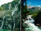
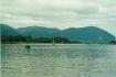
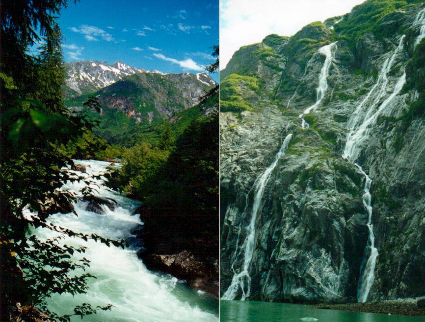
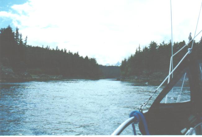
Falls along Tracy Arm
The narrow fjord of Tracy arm entranced us at
every turn. Each time we thought we had
seen the most spectacular waterfall cascading from a thousand feet above
us we would turn another corner and see one even more spectacular. We
could motor a few feet from the shore and our depth sounder's 400 foot maximum depth was inadequate to probe the water under
our keel.
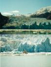
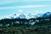
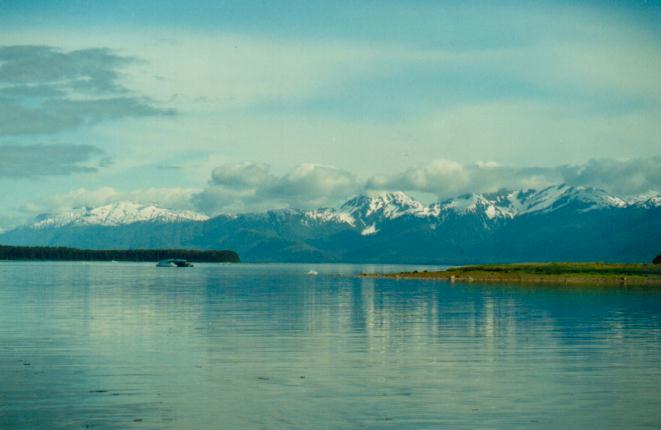
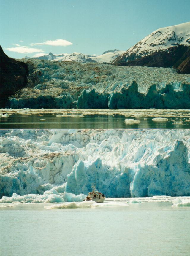
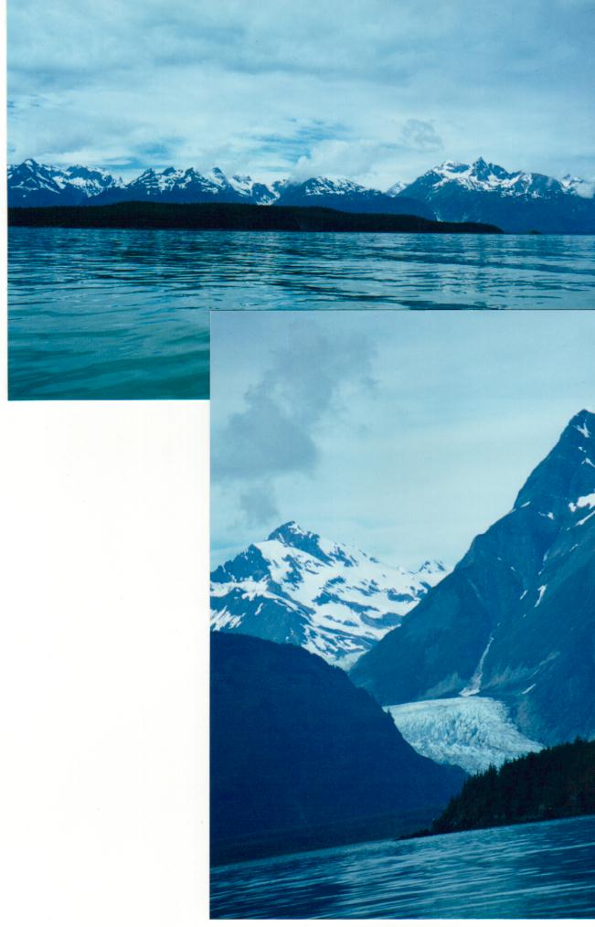
Glaciers at head of Tracy Arm
The real reason for traveling Tracy Arm was to see the two tide water
glaciers at its head. We were lucky enough
to get to the glaciers when the currents and wind had spaced the ice bergs far
enough apart to allow us to get as close as our comfort level would
allow. The glaciers were astounding. We were able to watch on
minor calving episode and even though it was small the
sound in the fjord was impressive.
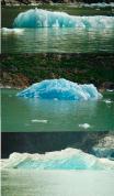
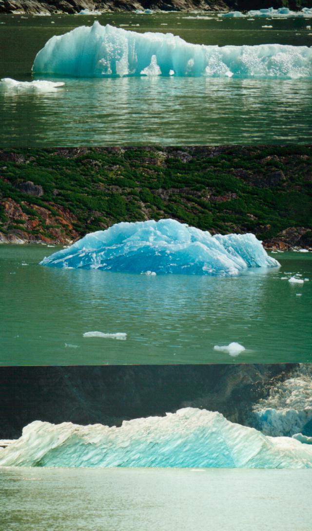
Icebergs
In Puget Sound we don't worry about ice bergs nor do we have the chance to appreciate their beauty and variety. After
reading Titanic stories we could only think of
them as evil things to watch out for. Now we look
forward to seeing what nature has hewed. I dove near a small "ice cube" version and found the under
water 90% fascinating as well. Mountain goats on the shear
cliffs are just visible with our large binoculars and barely make a white spot
on the photo taken through my longest lens.
We spent our second night in Tracy cove after
exiting Tracy Arm. It is a beautiful evening but there are lots of boats
now as the weekend is approaching and this is a common weekend trip from
Juneau.
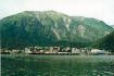
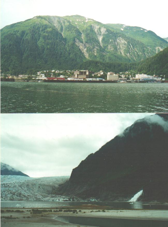
Juneau and Mendenhall Glacier
Map of Juneau area
We had gone to bed very concerned that we had cut our fuel budget too close and
might not make it to Juneau but awoke on July 9th to a perfect following wind
and had a free ride most of the rest of the way under the spinnaker. We
rented a car in Juneau and visited the sights including the Mendenhall Glacier
which comes to within a few miles of downtown.
We left Juneau at 9 PM so that we could traverse Gasineau Channel at maximum high tide since the
Mendenhall Bar consist of exposed mud flats
at any other time. We were unable to find any locals who had been
through the passage (it is marked) in the past
year to confirm if the depth markers at the entrance to the passage were
correct. We carefully wove our way through the marks in the twilight (our
expensive binoculars became invaluable) and hoped that the depth sounder
was reading correctly through the muddy water.
We made it through at 11 PM after passing the shallowest point
with only 3.8 ft of water under the boat (there is
something to be said for retractable keels and rudders).
Map - Juneau to Skagway
Boat Harbor passage
July 12th we motored up Favorite Channel. Clarice was determined to catch
one of the salmon that were jumping all around us but was unable to get them to
strike a lure. We set the GPS for the entrance to a small bay and were
about to question if the guidebook had misled us when we finally sighted the
narrow "J" shaped channel that led into the Boat Harbor bay.
Fish jumping in Boat Harbor
Once inside of Boat Harbor it was hard to convince ourselves that we were not
in a freshwater mountain lake. I counted 10 salmon out of the water at
one time and we were half expecting one to jump into the dingy on its
own.
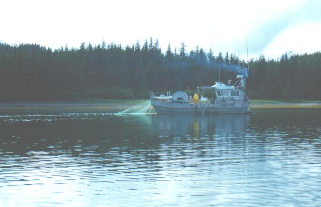
Gillnetter in Boat Harbor
Clarice finally gave up fishing (or I got tired of rowing her around) and we
decided to try to buy fish off a boat that was gill netting in the bay.
The fishermen laughed and told us that they were getting pretty sick of fish
and "charged" us the fee that we had to take two fish rather than
one. Three days later we were getting pretty tired of salmon too.
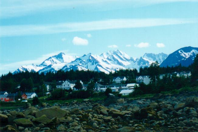
Haines
The next day we motored North up Lynn Canal and landed
in Haines. We enjoyed Haines because while cruise ships stop there
moderately frequently they don't own the town (literally). The town had a
more leisurely pace about it and we were able to buy art work at much lower
prices from the artists themselves.
Lynn Canal (Fjord)
Our final day traveling on the water we went from
Haines to Skagway where we were able to meet up with my father with very little
trouble. We toured the town and then pulled the boat out of the water on
July 15th. After fearing that we would find a month on a 26 foot boat to
be claustrophobic, we instead both felt a strange sadness that our home
"with the thousand mile backyard" was being taken from the water
where it belonged. We put Dad and his friend on the ferry to Juneau and
pulled the boat up the hill to Whitehorse Canada and started the next part of
our summer trek.
We hope to get the land portion of the trip on the web before too long.
If you are interested in following along then check back here periodically.
If you wish to comment, want to take a trip up the inside passage and want
further advice (piece of advice #1 - quit planning and just do it), or whatever
then we can be contacted at cmgregory@att.net .
go back to Canadian waters section
EXIT